Brotherton Map - 1759
This map is from Special Collections of the Rutgers University Libraries, specifically Alexander Library on College Avenue
at the Rutgers, New Brunswick campus.
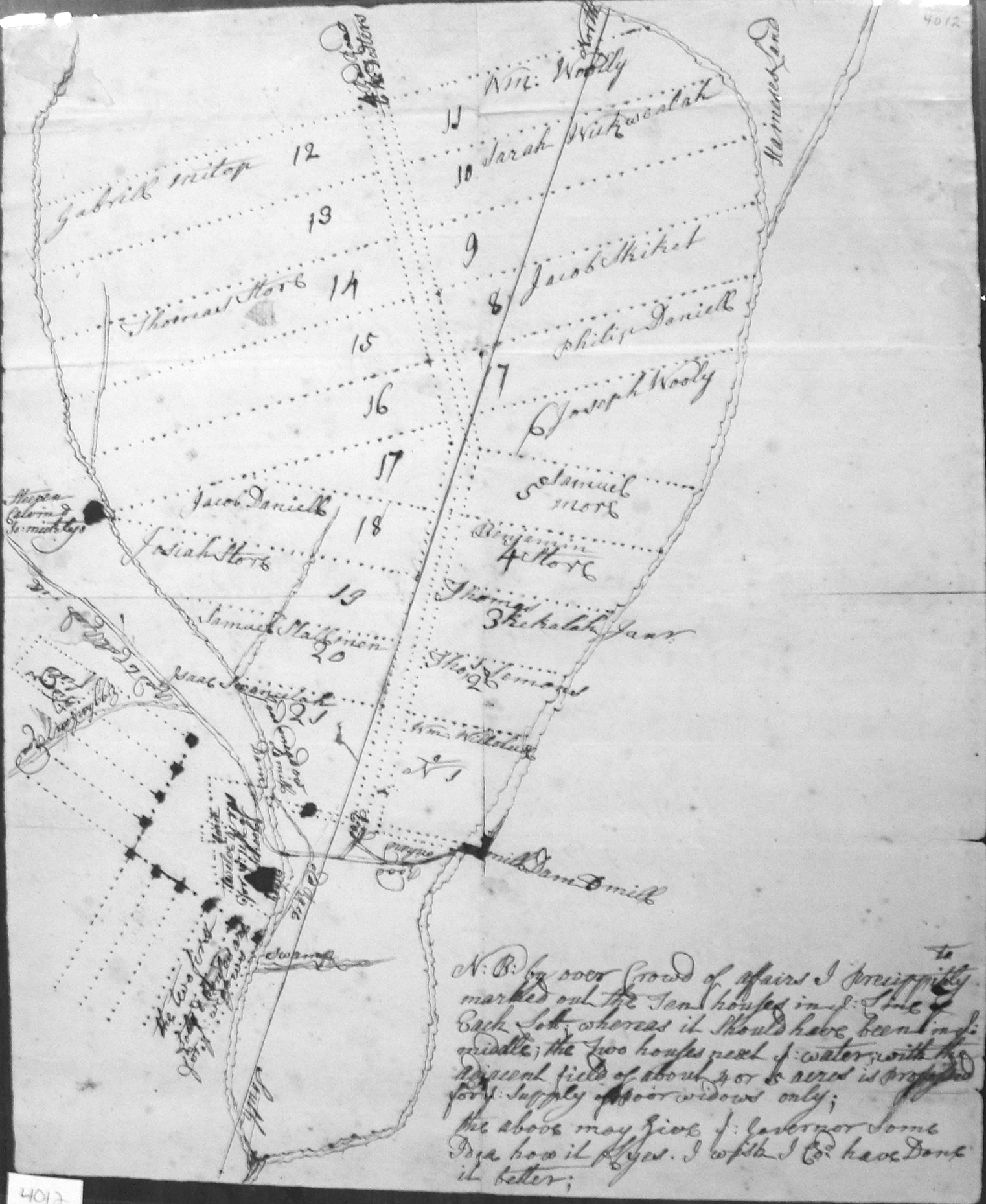
The map states: N:B: by over crowd of afairs I precippitly marked out the Ten houses in ye Line of Each
lot whereas it should have been in ye middle; the Two houses next to ye water, with the adjacent field of about 4 or
5 acres is proposed for ye supply of poor widows only; the above may give ye Governor Some Idea how it lyes.
I wish I cod. have Done it better;
Daniel Ellis put in a receipt for work on the map on December 5, 1760. The receipt is in his handwriting and states:
"Rec'd. of Charles Read Esqr the Sum of Fifty Shillings in full for Surveying and Drafting the Land Bought by the Commissioners
for the use of the Indians. I gave a Receipt for the Same Some time ago which cant be found. Decr. ye 5th:
1760
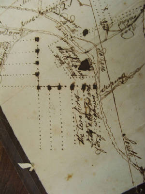
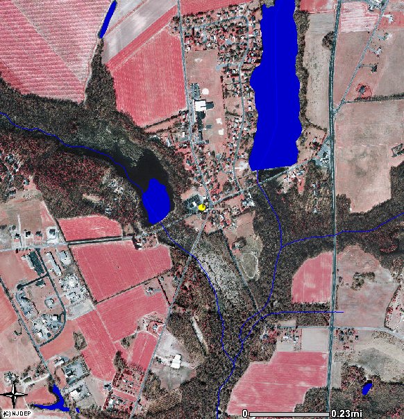
There are two houses on this map: one on the western stream is listed as Stephen Calvin & Joseph Micty.
The house at the lower left was known to be the residence of John Brainerd.
Note the layout of the ten cabins in an inverted L-shape. The site of this community is still in open space.
A map will be added shortly that shows the approximate location of the Indian church and cemetery and other sites associated
with the Brotherton Reservation. It is known that the Indian cemetery is now grown over.
This map shows that lots were set aside for the Indians. However, based upon the documents, it is not clear that
any of these lots were actively farmed or had houses placed upon them. To the contrary, the documents infer that these
lots were not necessarily controlled by those persons named on this map, or their descendents. More research needs to
be done to determine this question.
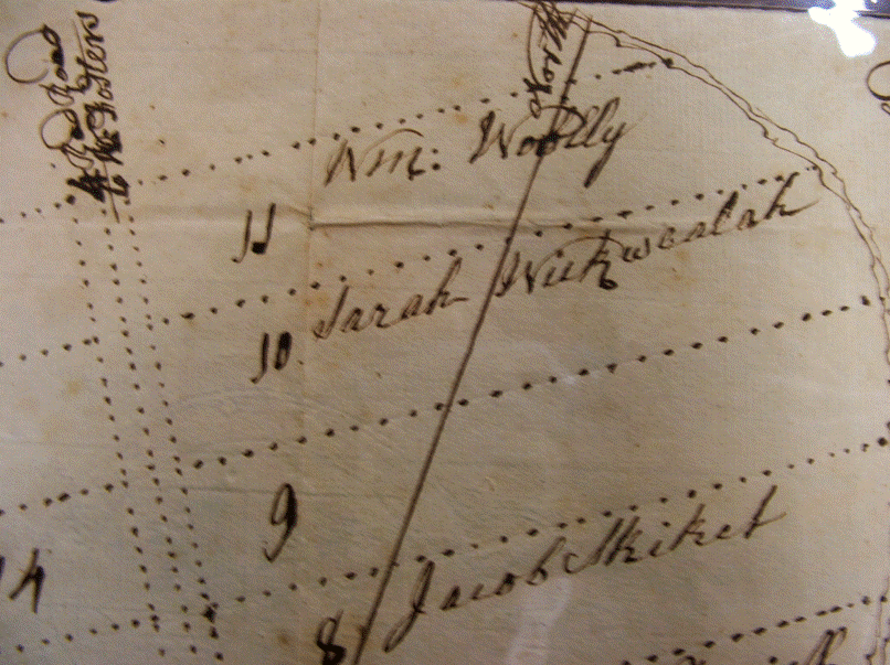
The lots were assigned as follows (names to be verified):
1. William Wilolux
2. Thomas Lemons
3. Thomas Kekalah (Joshua Kekalah represented the Brothertons in the Weekping matter vs. Foster)
4. Benjamin Store
5. Samuel More (moved to the Ohio country and was killed at Gnadenhutten, March 8, 1782)
6. Joseph Wooly
7. Philip Daniell
8. Jacob Skiket
9. vacant
10. Sarah Wickwealah (widow of Wequeheela)
11. William Wooley
12. Gabrill Mitop
13. vacant
14. Thomas Store
15. - 17. vacant
18. Jacob Daniell
19. Josiah Store
20. Ismail Slallomen
21. Isaac Swanulah
The newly laid-out roads include one leading to the north, called the Road to Fosters, and another west-east road which
is present-day Willow Grove Road, or County 648.